AirScope - Air Traffic in ATC style for VATSIM, IVAO and ADS-B.
AirScope is a plane plotter that retrieves aircraft positions and measurements from online sources and displays them on top of a world map in radar / ATC style.
When flying online with VATSIM or IVAO (or even as preparation for a flight in one of these networks) it's often useful to have an overview of who's in the air at any given moment or which ATC positions are currently filled and online. AirScope shows just that in a stylish universal interface for iPad, iPhone (iOS) and Mac (macOS) devices.


Positions currently online are also plotted / shaped and shown on the map together with their frequencies so that virtual pilots can contact them should they enter their airspace.
The ADS-B Interface
But that's not it; AirScope also displays real traffic as it's currently flying above our heads in the same style and interface.The ADS-B Interface allows you to connect AirScope to your local receiver and display traffic data as it's being broadcast.
With the advent of SDR (Software Defined Radio) there are numerous ways of building affordable ADS-B receivers nowadays. We recommend looking at RTL-SDR.COM for an introduction. If you don't want too much hassle, FlightAware have these really cool and ready to use dongles with a built in LNA (amplifier) and 1090 frequency filters which are worth checking on Amazon.
AirScope can connect to a computer with one of these receivers and an instance of dump1090 to recognise messages in SBS (BaseStation) format on a TCP port (default 30003) and plot air traffic on its map.
On top of that, with the built-in complimentary cloud based ADS-B you can see traffic from various places in the world (basically where there's voluntary coverage) even without being there or having a receiver yourself. Note that this service, while useful, is provided on a complimentary basis and may not always produce accurate positions and may cease at any given time. It's however safe to say that for now and foreseable future it should be operational for 99% of the time.
The ADS-B Interface functionality is enabled and available by a low cost in-app purchase which aims at mitigating its inherent bandwidth costs.
Using the Map
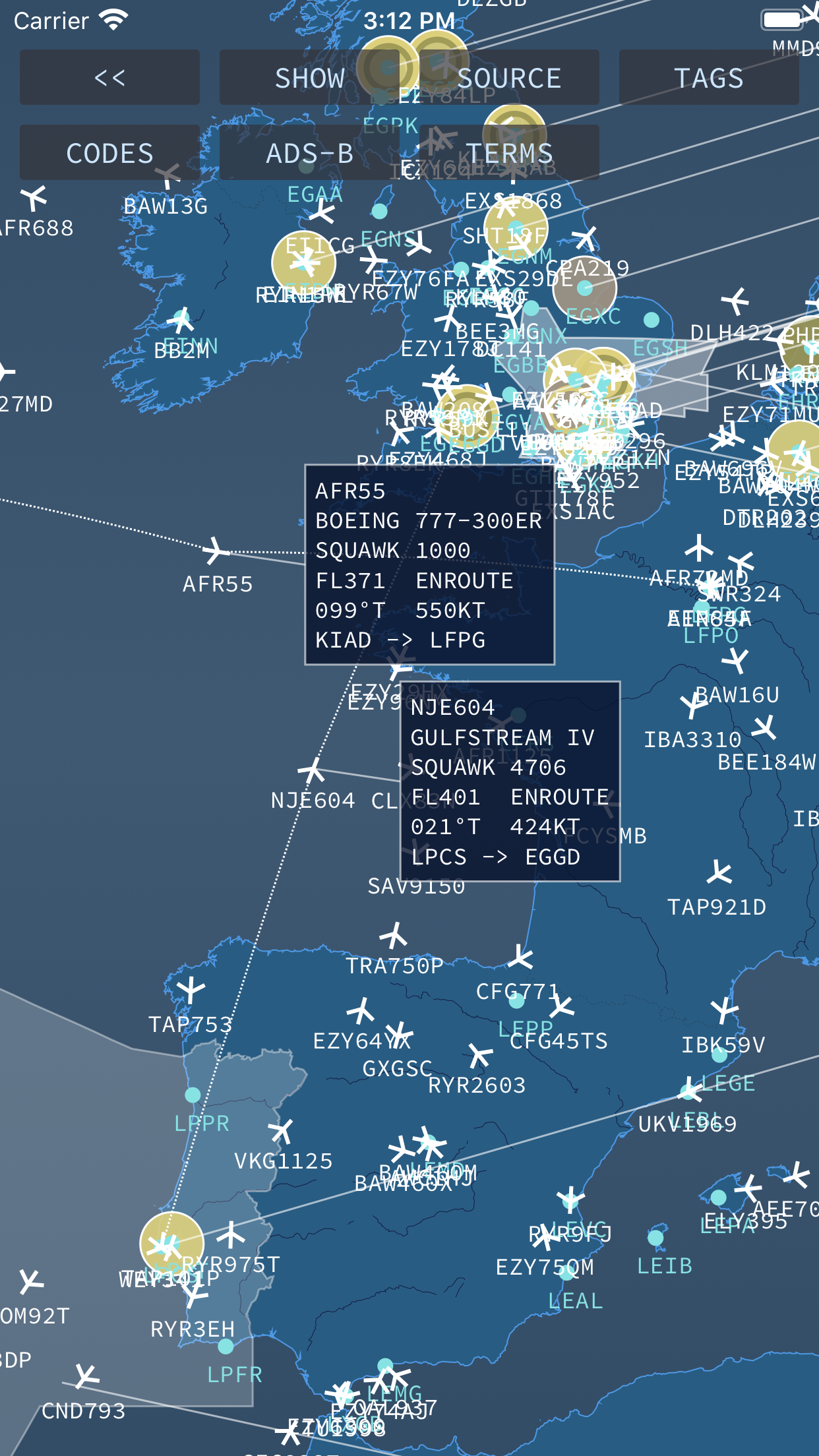
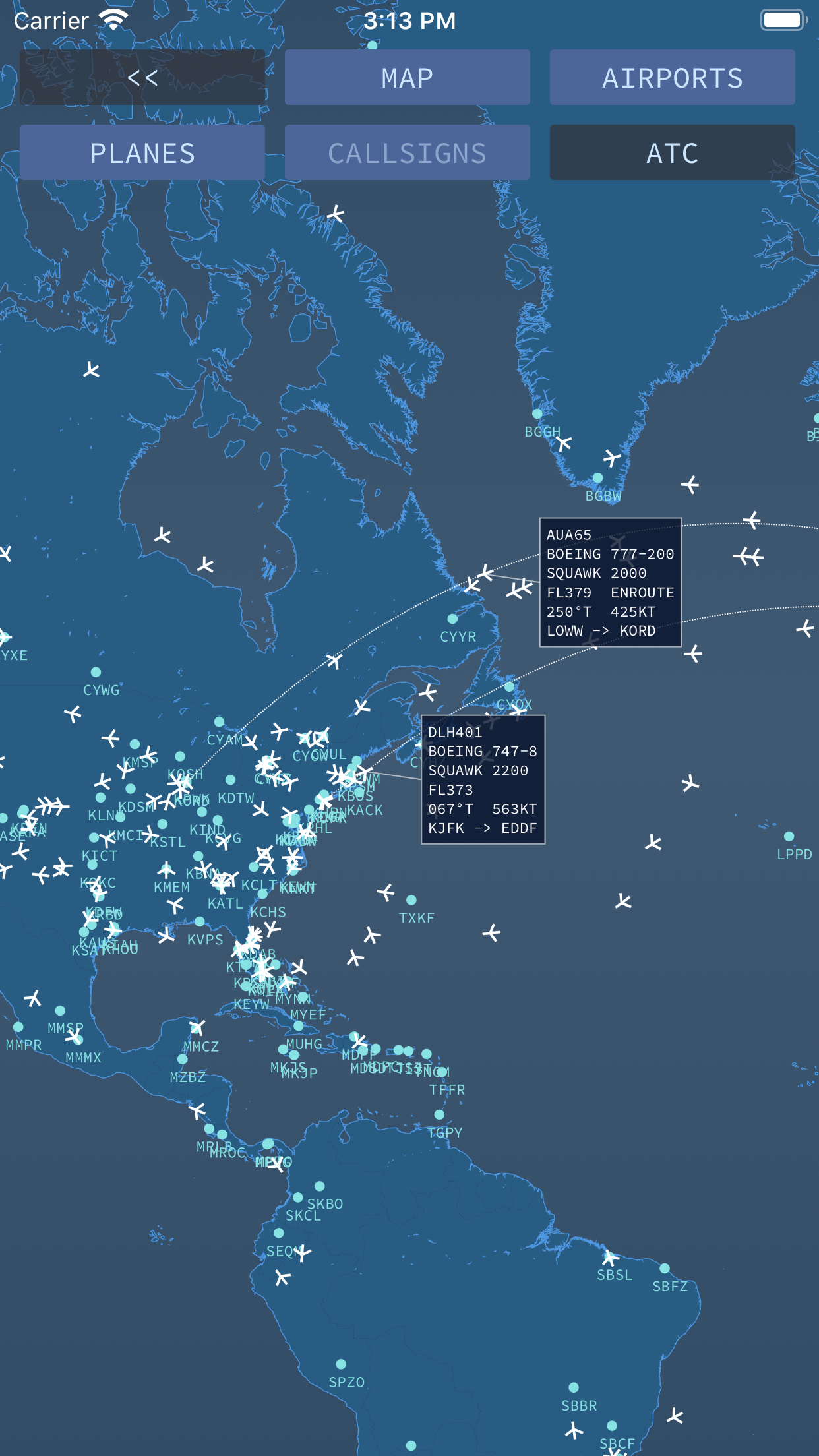
The app usage is fairly straight forward. Use pinch gestures to zoom in or out and pan gestures to move around the globe. Planes as received are represented in white (and yellow for locally detected ADS-B planes). Tapping on a plane discloses a tag with information about its flight. Tapping again closes the tag.
Tapping and holding on a tag allows it to be dragged elsewhere in order to give visibility to anything hidden underneath it.
Update Times
VATSIM and IVAO traffic is updated every 2 or 1 minute, depending on the refresh setting given in the network's traffic file. ADS-B traffic is immediate meaning that as soon as an update is available it is sent and processed by the app within a second or two.
Settings
Settings are disclosed by tapping on the top left button on the screen.
The SHOW button controls what is to be and isn't to be displayed on the map, namely, the Mao itself, Airports (represented by little cyan circles), Planes (as they fly), Callsigns (the text below each plane icon) and ATC (for VATSIM and IVAO only).
More Settings
The SOURCE button allows selecting the source of traffic.
TAGS allows the user to configure which options should appear inside a plane's tag namely, the Callsign, Squawk Code, Aircraft Type, Altitude, Vertical Speed, Flight Stage, Heading (True), Speed (GS) and Departure and Arrival airports (when available). The PHONETIC option makes some of the tag values be displayed in a more human phonetic form; for the CALLSIGN an attempt to translate the airline ICAO to it's radio callsign is made and shown if successful and for Aircraft the make and model of the Aircraft is shown instead of its ICAO code.
The CODES button allows to select if whether ICAO or IATA codes are preferred to represent aircraft, airlines and airports.
The ADSB allows the configuration of the ADS-B data source; at first it leads the user to the requied in-app purchase. Once successfully bought this key allows the IP address and TCP port of the ADS-B receiver to be configured and to enable/disable cloud services.
The TERMS button shows the terms and conditions.