OceanTrack - AIS Ships
Panning and zooming the map influence which ships appear on the list so selecting a given region of the globle will make ships on that region appear on this page as cloud AIS is global.
NMEA received AIS targets however (i.e. those definitely around us as received by the onboard instruments) are always shown so there's no risk of missing them, and because they're sorted by distance, they will generally appear first on the list.

The SHIPS list
The list provides information such as their origin, MMSI, type, name, speed, course, plus distance and bearing from us. The green lines represent AIS class A transponders (usually bigger vessels with more detailed information) whereas blue lines represent class B ships (typically smaller, with less information).
To save bandwidth and optimise performance there's a built in limit of 1000 cloud ships that are downloaded at any given time, so if more are in the selected region only the closest are shown.
Tapping on a row leads to the Ship Details and discloses further information about the selected target.
Ships without name:
It often happens (especially after launching the app and for NMEA targets) that the name of a ship is not yet available but its coordinates, speed and course are. This is because there are different types of AIS messages and the frequency of position reports being sent is higher than the frequency of static data such as a ship's name or dimensions which doesn't change as often and is only broadcast every couple of minutes. When this happens the app will display the ships without name.
OceanTrack minimises this delay by its cacheing capability so once it learns the name of a ship for a given MMSI, it stores it for future appearances. The cloud service also delivers recent static information on launch for cloud targets, so this also decreases the time it takes to find a ship's name.
Ship Details:
This page shows various details about the chosen target and is mostly self explanatory. All information is shown as received from AIS, either through NMEA or the cloud service.
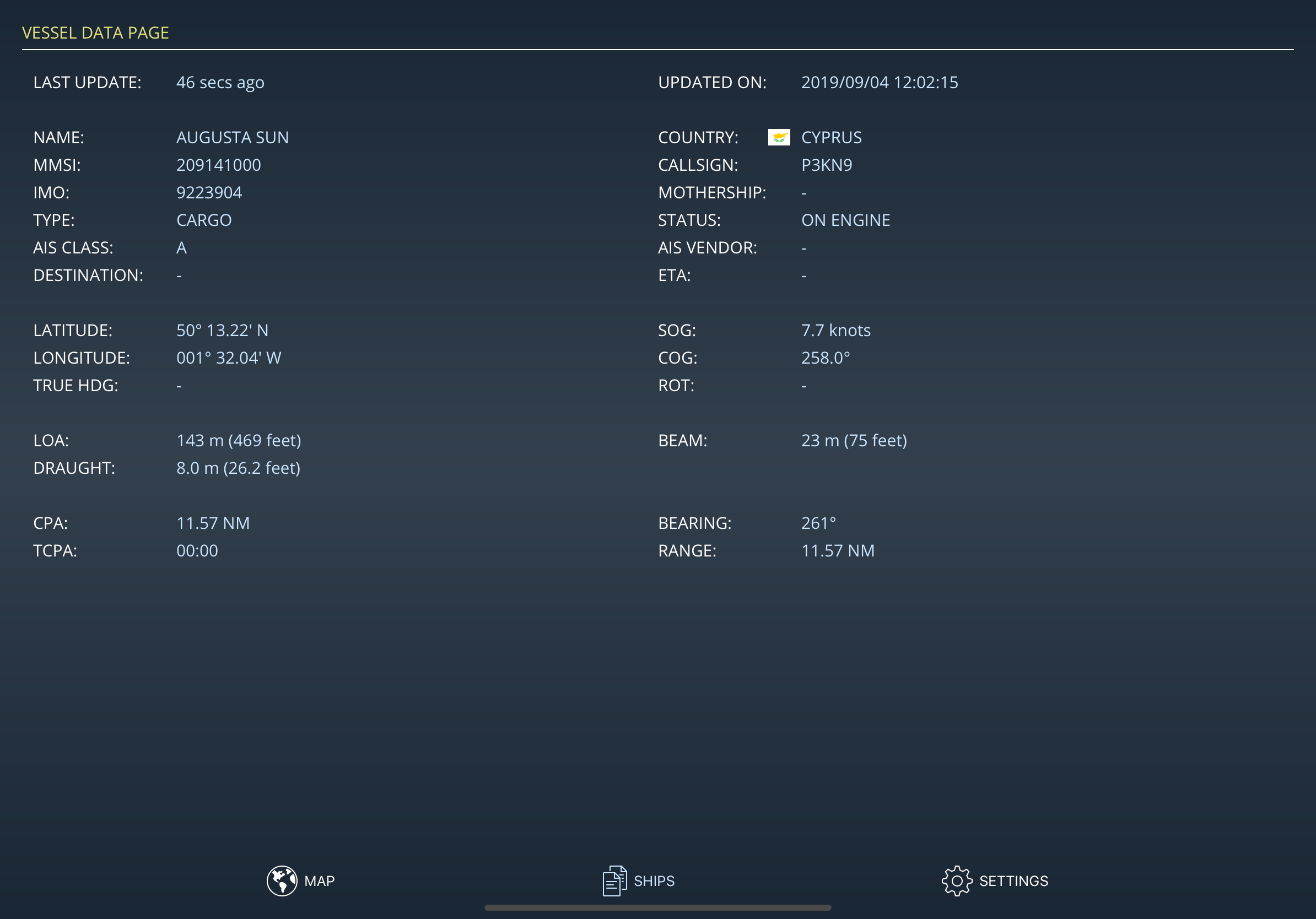
SHIP / AIS Target Details
The amount of information displayed depends on various factors and types of AIS messages. Dynamic data such as position reports is sent/received more often than static data so some fields may only show when available at a later stage. AIS class A static data typically comprises more information than class B so some vessels may have an IMO or MOTHERSHIP for example where others may not. Lastly, also bear in mind that some information is manually entered (such as DESTINATION and ETA) and may also not be available or may be incorrect.
Bearing and range are with regards to the own urrent position as determined by GPS. CPA and TCPA are calculated taking into account both ships (target and ours) speeds and courses.
Next topic: Settings