Waypoints
Custom Waypoints
The AirTrack navigation features understand several different types of waypoint: FIX, VORs,NDBs, Airports, Localizers are the standard built-in ones. In addition to these we've introduced CWPs or custom waypoints. Say you want to bookmark your home using a GPS source or want to save a nice scenic place while flying with the simulator; it couldn't be easier, just select NEW WP, provide a code for your waypoint comprising up to 6 characters or digits and save. Your current position is saved and you can now use it for route plans and can see it on the navigation display. By default your current coordinates are used, but you may change them too, thus creating other points around the world. Clicking on a specific waypoint will disclose further information about it, as well as letting you delete it. You will be given information abouts its position as well as its bearing and distance from your current position.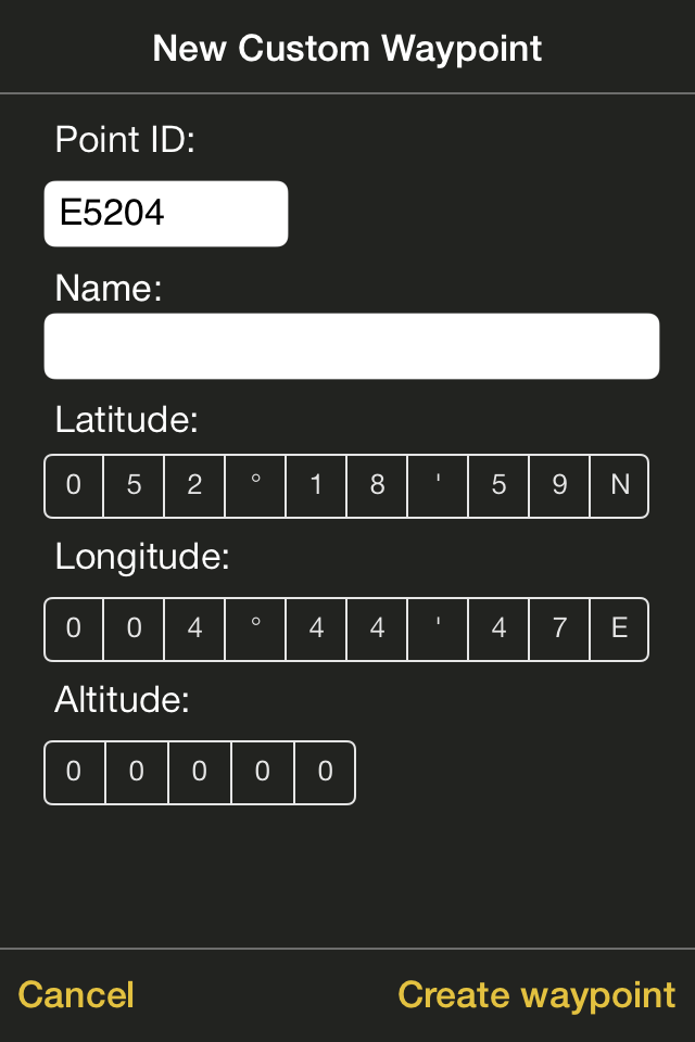
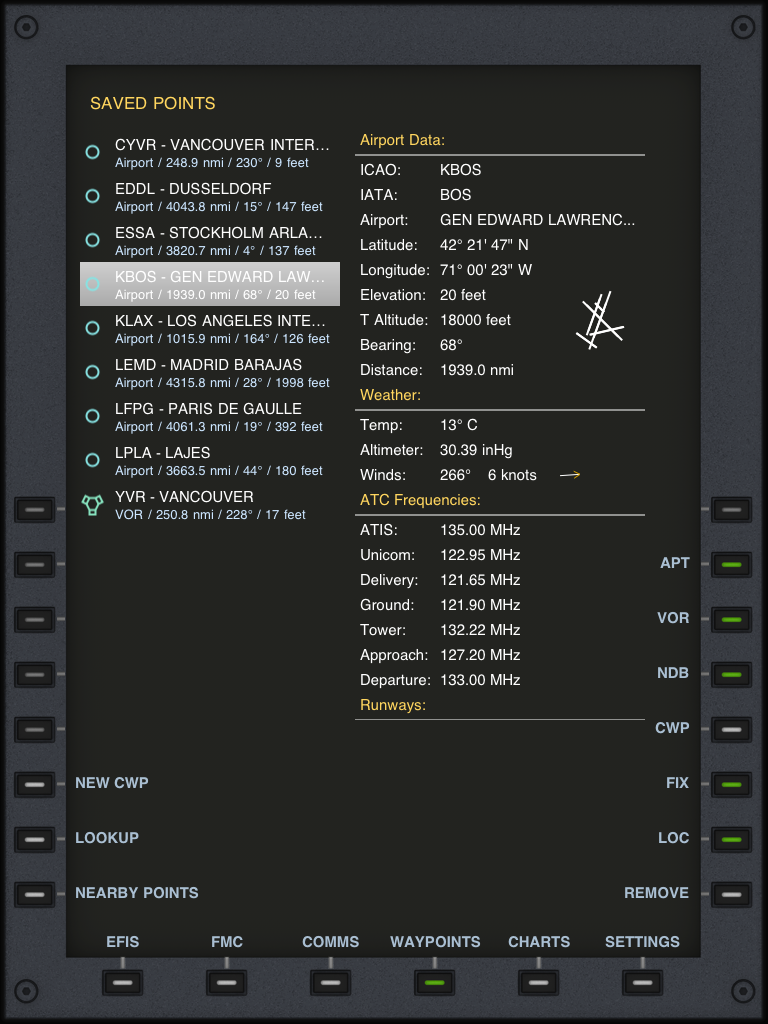
Saved Waypoints
Just like custom waypoints, you can add a list of your favourite points in the Saved section.Just lookup for their code and select them. You can add Aiports, VORs, NDBs, FIXes and Localities.
The buttons below allow you to control which types of waypoints are displayed on the list
Nearby Waypoints
Alternatively, the Nearby section gives you a list of all points found in the database that are nearby as well as their relative bearing and distance.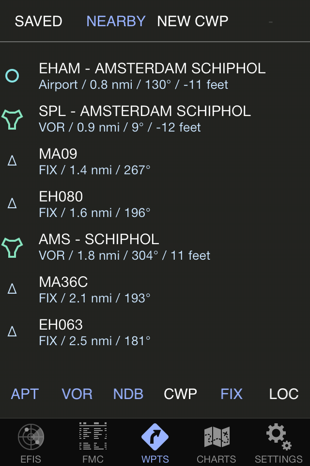
Airport Information
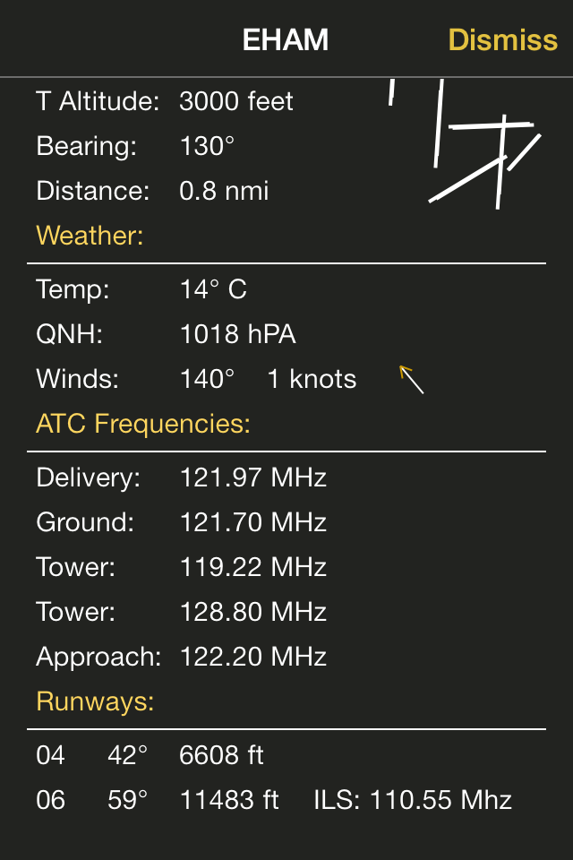
By clicking on any airport you will disclose further information about the airport. The airport viewer will display the positioning of the airport, its bearing and distance from your current position and a graphical clue display of the runway disposition. Individual information per runway is also provided. If the runway has an ILS localizer, its frequency is displayed. If your device has Internet connectivity, an attempt to download a METAR for the selected airports will be performed. If successfull, this page will also display the current weather at the selected airport as provided by the METAR.Points Information
Other point types display other types of information. For instance, on a VOR you will have its class, its range and its frequency.
On the iPad
The waypoint or airport list and the detailed information all fit in one screen:
Cloud Based Waypoint Syncing
By logging in with an Air Account and enabling waypoint syncing, all waypoints locally created or saved on the device are automatically uploaded to the cloud at the first opportunity. Following this, all other devices associated with the same Air Account receive the saved or created waypoints and maintain a consise replica of these.
Create a waypoint while on the road and when you get home it will be automatically propaged to all other devices and saved in the cloud.
In addition to this, a cloud-based custom waypoint editor allows you to create your own custom waypoints on the Air Web Site using a standard browser, and getting these automatically streamed down to all your device.