The Nav Data PanelAirTrack comes with a built-in navigation data set called an AIRAC. The data is significantly old and out of date, courtesy of Navigraph. It's good for basic flight but if you fly online in networks such as VATSIM or IVAO, you may need a more up to date AIRAC. There is the possibility of subscribing / logging into Navigraph at their web site for the latest cycle, or to subscribe US centric FAA CIFP from within the app. In either case, the Nav Data page allows the selection and download of data sets or AIRACS. This data objects are then used throughout the app for flight planning, radio navigation and all other intents and purposes. 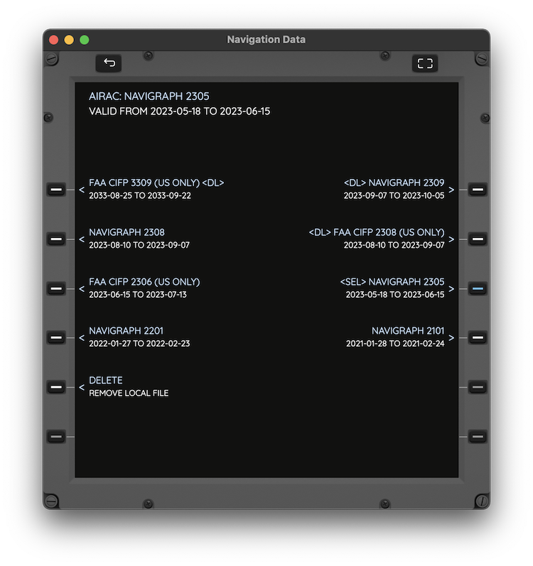
Custom WaypointsThere is also the possibility of adding your own FIX waypoints to the database and using them in every aspect of flight planning throughout the app. For each user point you specify a max 7 character identifier, a more descriptive name, latitude, longitude and altitude. 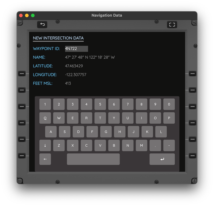 |
Lookup, Nearby and Saved PointsAirTrack then allows you to browse through that same navigation data by either looking up its identifier or by showing all surrounding objects. The objects found are then separated by type specific pages through LSKs namely, AIRPORTS, VOR/DME/TACANs, FIXes, NDBs and CUSTOM points, and presented sorted by distance from the current location.
Details PageEach nav data point type can be queried and shown its associated data. Airports are an extremely complete type in that they they include information about the airfield such as name, codes, transition altitudes, position, current weather, available runways, localizers, relative runway orientation, ATC frequencies, and the list of procedures of SID, STAR and Approach types. The following image depicts part of an airport's details page: 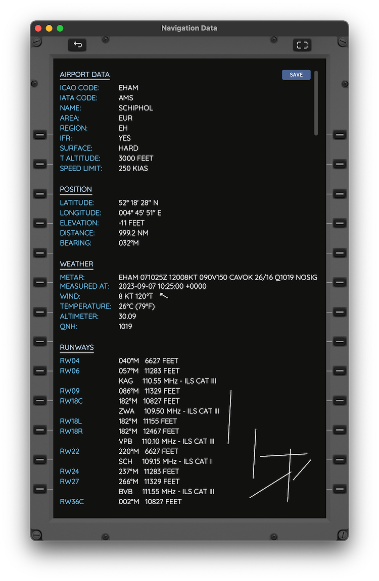
Saving PointsEach point can be saved (or forgotten) in its details page. Saved points can then be quickly accessed from the SAVED page. When using an Air Account, saved points are also uploaded and synced across devices seamlessly. This service allows allows management of custom waypoints on the web site. Next topic: Charts and Documents |